 vesseltracker.com
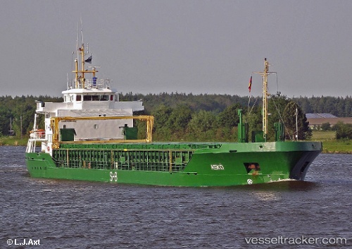
 KEIT
KEIT
Current Status
Where is the vessel?
KEIT is currently in Near Breiholz, based on AIS data received less than 1h ago.
Latest AIS update:
Current position: 54.19246° N, 9.53125° E (Near Breiholz)
Average speed (last 7 days): Loading…
Average speed (last 30 days): Loading…
Vessel profile: KEIT is a General Cargo with dimensions m x m.
This page combines live AIS, route history, probable destination signals, nearby traffic, and port activity for practical vessel monitoring.
The current position of vessel KEIT is 54.19246 lat / 9.53125 lng. Updated: 2026-04-01 13:55:33 UTCNearest reference points:
- Near BORGSTEDT
- Near Busdorf bei Schleswig
- Near Fahrdorf
Currently sailing under the flag of Antigua and Barbuda ![]()
Details:
Live Vessel KEIT Analytics (details, animations, etc.)
Recent AIS points (UTC):
2026-04-01 07:53:02 UTC · 54.48034, 10.26780 · SOG 10.6 kn · COG 207°2026-04-01 09:24:12 UTC · 54.36606, 10.14128 · SOG 0 kn · COG 284°
2026-04-01 11:54:23 UTC · 54.35697, 9.78037 · SOG 7.1 kn · COG 230°
2026-04-01 13:55:33 UTC · 54.19246, 9.53125 · SOG 6.8 kn · COG 250°