 vesseltracker.com
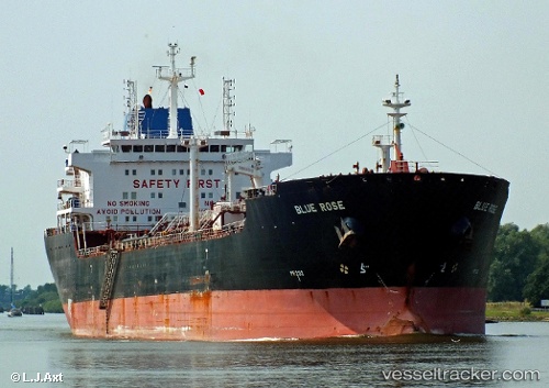
 Blue Rose
Current Status
Where is the vessel?
Blue Rose is currently in 29 nm N of Port Said, based on AIS data received less than 1h ago.
Latest AIS update:
Current position: 31.74321° N, 32.27691° E (29 nm N of Port Said)
Average speed (last 7 days): Loading…
Average speed (last 30 days): Loading…
Vessel profile: Blue Rose is a Chemical Oil Products Tanker with dimensions 183m x 27m.
This page combines live AIS, route history, probable destination signals, nearby traffic, and port activity for practical vessel monitoring.
The current position of vessel Blue Rose is 31.74321 lat / 32.27691 lng. Updated: 2026-04-12 10:06:45 UTCNearest reference points:
- 21 nm N of Port Said
- 16 nm N of Port Said
- 15 nm N of Port Said
Currently sailing under the flag of Marshall Is ![]()
Blue Rose built in 2007 year
Deadweight:
38402 tDetails:
Live Vessel Blue Rose Analytics (details, animations, etc.)
Recent AIS points (UTC):
2026-04-10 07:04:33 UTC · 31.59619, 32.34485 · SOG 0 kn · COG 265°2026-04-12 06:26:26 UTC · 31.74294, 32.27671 · SOG 0.1 kn · COG -1°
2026-04-12 07:51:33 UTC · 31.74307, 32.27682 · SOG 0 kn · COG -1°
2026-04-12 10:06:45 UTC · 31.74321, 32.27691 · SOG 0.1 kn · COG -1°