 vesseltracker.com
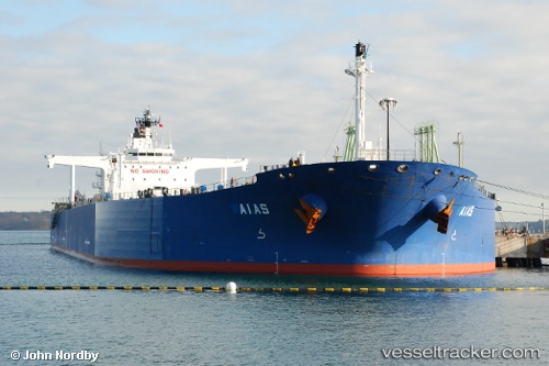
 SPETSA
Current Status
Where is the vessel?
SPETSA is currently in Near SKAGEN, based on AIS data received about 1d ago.
Latest AIS update:
Current position: 57.60700° N, 10.70322° E (Near SKAGEN)
Average speed (last 7 days): Loading…
Average speed (last 30 days): Loading…
Vessel profile: SPETSA is a Crude Oil Tanker with dimensions m x m.
This page combines live AIS, route history, probable destination signals, nearby traffic, and port activity for practical vessel monitoring.
The current position of vessel SPETSA is 57.60700 lat / 10.70322 lng. Updated: 2026-04-10 07:26:03 UTCNearest reference points:
- Near SKAGEN
- Near Frederikshavn
- 19 nm E of Sæby
Currently sailing under the flag of Liberia ![]()
Details:
Live Vessel SPETSA Analytics (details, animations, etc.)
Recent AIS points (UTC):
2026-04-10 02:22:47 UTC · 57.60615, 10.70299 · SOG 1.1 kn · COG 129°2026-04-10 03:47:14 UTC · 57.60500, 10.70167 · SOG 0 kn · COG -1°
2026-04-10 05:56:05 UTC · 57.60713, 10.70361 · SOG 0.7 kn · COG 170°
2026-04-10 07:26:03 UTC · 57.60700, 10.70322 · SOG 1 kn · COG 140°