 vesseltracker.com
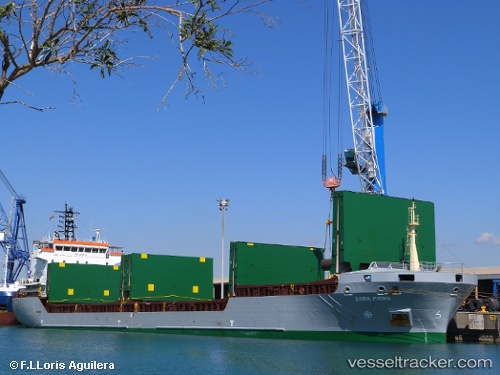
 LUCITA
Current Status
Where is the vessel?
LUCITA is currently in 24 nm SE of ROQUETAS DE MAR, based on AIS data received less than 1h ago.
Latest AIS update:
Current position: 36.41389° N, 2.36453° W (24 nm SE of ROQUETAS DE MAR)
Average speed (last 7 days): Loading…
Average speed (last 30 days): Loading…
Vessel profile: LUCITA is a General Cargo Ship with dimensions 108m x 18m.
This page combines live AIS, route history, probable destination signals, nearby traffic, and port activity for practical vessel monitoring.
The current position of vessel LUCITA is 36.41389 lat / -2.36453 lng. Updated: 2026-03-29 09:53:25 UTCNearest reference points:
- 26 nm S of El Alquian
- 27 nm SE of El Alquian
- 37 nm S of Las Noras de Daza
Currently sailing under the flag of Portugal (MAR) ![]()
LUCITA built in 2005 year
Deadweight:
7601 tDetails:
Live Vessel LUCITA Analytics (details, animations, etc.)
Recent AIS points (UTC):
2026-03-29 03:22:03 UTC · 36.62667, -0.97667 · SOG 10 kn · COG -1°2026-03-29 05:33:27 UTC · 36.55586, -1.42335 · SOG 9.7 kn · COG 259°
2026-03-29 08:22:32 UTC · 36.46462, -2.01951 · SOG 10.8 kn · COG -1°
2026-03-29 09:53:25 UTC · 36.41389, -2.36453 · SOG 11.2 kn · COG 264°