 vesseltracker.com
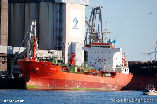
 MENTOR
Current Status
Where is the vessel?
MENTOR is currently in Near Ile D’Ouessant, based on AIS data received about 1h ago.
Latest AIS update:
Current position: 48.69303° N, 5.66930° W (Near Ile D’Ouessant)
Average speed (last 7 days): Loading…
Average speed (last 30 days): Loading…
Vessel profile: MENTOR is a Oil/Chemical Tanker with dimensions m x m.
This page combines live AIS, route history, probable destination signals, nearby traffic, and port activity for practical vessel monitoring.
The current position of vessel MENTOR is 48.69303 lat / -5.66930 lng. Updated: 2026-04-01 06:17:51 UTCNearest reference points:
- 16 nm NW of Ile D’Ouessant
- 18 nm NE of Ile D’Ouessant
- Near Creac'h-Point
Currently sailing under the flag of Antigua and Barbuda ![]()
Details:
Live Vessel MENTOR Analytics (details, animations, etc.)
Recent AIS points (UTC):
2026-03-31 23:41:22 UTC · 47.47722, -6.71399 · SOG 11.7 kn · COG 35°2026-04-01 01:40:52 UTC · 47.84807, -6.39195 · SOG 13.2 kn · COG 31°
2026-04-01 04:02:52 UTC · 48.29647, -5.99891 · SOG 12.5 kn · COG 28°
2026-04-01 06:17:51 UTC · 48.69303, -5.66930 · SOG 11.6 kn · COG 25°