 vesseltracker.com
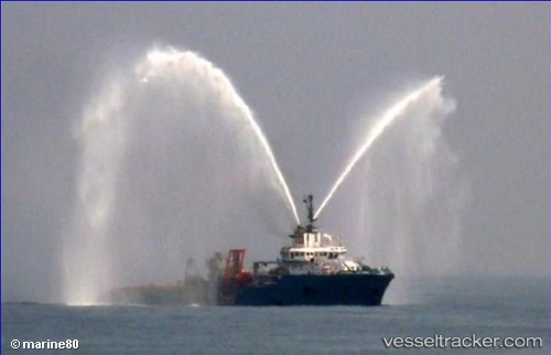
 ASGARD
Current Status
Where is the vessel?
ASGARD is currently in 13 nm S of Brass River, based on AIS data received about 2h ago.
Latest AIS update:
Current position: 3.86539° N, 6.35926° E (13 nm S of Brass River)
Average speed (last 7 days): Loading…
Average speed (last 30 days): Loading…
Vessel profile: ASGARD is a Anchor Handling Vessel with dimensions m x m.
This page combines live AIS, route history, probable destination signals, nearby traffic, and port activity for practical vessel monitoring.
The current position of vessel ASGARD is 3.86539 lat / 6.35926 lng. Updated: 2026-04-04 06:31:51 UTCNearest reference points:
- 12 nm N of Okwori
- 21 nm SW of Bonny
- Near Bonny
Currently sailing under the flag of Liberia ![]()
Details:
Live Vessel ASGARD Analytics (details, animations, etc.)
Recent AIS points (UTC):
2026-04-04 01:28:41 UTC · 3.86447, 6.35951 · SOG 0.6 kn · COG 102°2026-04-04 03:26:08 UTC · 3.86439, 6.35958 · SOG 0.2 kn · COG 78°
2026-04-04 05:34:39 UTC · 3.86596, 6.35914 · SOG 0.2 kn · COG 72°
2026-04-04 06:31:51 UTC · 3.86539, 6.35926 · SOG 0.2 kn · COG 84°