 vesseltracker.com
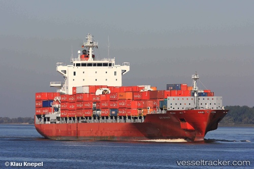
 DELOS WAVE
Current Status
Where is the vessel?
DELOS WAVE is currently in 66 nm E of Beerwah, based on AIS data received about 1h ago.
Latest AIS update:
Current position: 27.23833° S, 154.82666° E (66 nm E of Beerwah)
Average speed (last 7 days): Loading…
Average speed (last 30 days): Loading…
Vessel profile: DELOS WAVE is a Container Ship with dimensions m x m.
This page combines live AIS, route history, probable destination signals, nearby traffic, and port activity for practical vessel monitoring.
The current position of vessel DELOS WAVE is -27.23833 lat / 154.82666 lng. Updated: 2026-04-01 15:29:48 UTCNearest reference points:
- Near Bulwer
- Near Pimpama
- Near Biggera Waters
Currently sailing under the flag of Malta ![]()
Details:
Live Vessel DELOS WAVE Analytics (details, animations, etc.)
Recent AIS points (UTC):
2026-04-01 09:47:23 UTC · -26.71593, 153.44614 · SOG 14.2 kn · COG 90°2026-04-01 11:35:00 UTC · -26.88183, 153.87448 · SOG 13.9 kn · COG 109°
2026-04-01 13:22:07 UTC · -27.05273, 154.30499 · SOG 13.9 kn · COG 107°
2026-04-01 15:29:48 UTC · -27.23833, 154.82666 · SOG 14 kn · COG -1°