 vesseltracker.com
 PELAGIC TOPE
Current Status
Where is the vessel?
PELAGIC TOPE is currently in 66 nm SW of Gulfmex Lightering Area, based on AIS data received about 1h ago.
Latest AIS update:
Current position: 27.12210° N, 91.84963° W (66 nm SW of Gulfmex Lightering Area)
Average speed (last 7 days): Loading…
Average speed (last 30 days): Loading…
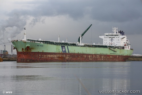
Vessel profile: PELAGIC TOPE is a Oil Products Tanker with dimensions 228m x 32m.
This page combines live AIS, route history, probable destination signals, nearby traffic, and port activity for practical vessel monitoring.
The current position of vessel PELAGIC TOPE is 27.12210 lat / -91.84963 lng. Updated: 2026-03-28 00:14:01 UTCNearest reference points:
- 83 nm W of Gulfmex Lightering Area
- 94 nm S of Gulfmex Lightering Area
- 97 nm W of Gulfmex Lightering Area
Currently sailing under the flag of Cyprus ![]()
PELAGIC TOPE built in 2008 year
Deadweight:
76578 tDetails:
Live Vessel PELAGIC TOPE Analytics (details, animations, etc.)
Recent AIS points (UTC):
2026-03-27 17:58:51 UTC · 28.08323, -92.77205 · SOG 11.8 kn · COG -1°2026-03-27 19:33:10 UTC · 27.83298, -92.56063 · SOG 11.6 kn · COG -1°
2026-03-27 21:24:10 UTC · 27.59588, -92.23423 · SOG 12.5 kn · COG 140°
2026-03-28 00:14:01 UTC · 27.12210, -91.84963 · SOG 11.8 kn · COG 142°