 vesseltracker.com
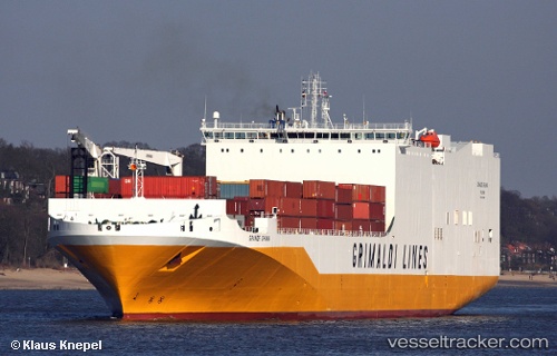
 Grande Ghana
Current Status
Where is the vessel?
Grande Ghana is currently in Near Verrebroek, based on AIS data received less than 1h ago.
Latest AIS update:
Current position: 51.28044° N, 4.22141° E (Near Verrebroek)
Average speed (last 7 days): Loading…
Average speed (last 30 days): Loading…
Vessel profile: Grande Ghana is a Vehicles Carrier with dimensions 210m x 210m.
This page combines live AIS, route history, probable destination signals, nearby traffic, and port activity for practical vessel monitoring.
The current position of vessel Grande Ghana is 51.28044 lat / 4.22141 lng. Updated: 2026-03-31 23:49:04 UTCNearest reference points:
- Near Verrebroek
- Near Doel
- Near Kallo
Currently sailing under the flag of Italy ![]()
Grande Ghana built in 2009 year
Deadweight:
25000 tDetails:
Live Vessel Grande Ghana Analytics (details, animations, etc.)
Recent AIS points (UTC):
2026-03-31 18:19:42 UTC · 51.28046, 4.22143 · SOG 0 kn · COG 218°2026-03-31 19:50:10 UTC · 51.28043, 4.22139 · SOG 0 kn · COG -1°
2026-03-31 22:19:45 UTC · 51.28042, 4.22142 · SOG 0 kn · COG 218°
2026-03-31 23:49:04 UTC · 51.28044, 4.22141 · SOG 0 kn · COG -1°