 vesseltracker.com
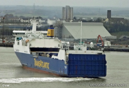
 Thuleland
Current Status
Where is the vessel?
Thuleland is currently in Near Orford, based on AIS data received about 1h ago.
Latest AIS update:
Current position: 52.03131° N, 1.71258° E (Near Orford)
Average speed (last 7 days): Loading…
Average speed (last 30 days): Loading…
Vessel profile: Thuleland is a Ro Ro Cargo Ship with dimensions 191m x 26m.
This page combines live AIS, route history, probable destination signals, nearby traffic, and port activity for practical vessel monitoring.
The current position of vessel Thuleland is 52.03131 lat / 1.71258 lng. Updated: 2026-03-29 21:37:42 UTCNearest reference points:
- 11 nm NW of Krieschow
- Near Dovercourt
- Near Felixstowe
Currently sailing under the flag of Sweden ![]()
Thuleland built in 2006 year
Deadweight:
13800 tDetails:
Live Vessel Thuleland Analytics (details, animations, etc.)
Recent AIS points (UTC):
2026-03-29 16:18:41 UTC · 51.94819, 1.24260 · SOG 0.1 kn · COG 266°2026-03-29 18:23:26 UTC · 51.94819, 1.24261 · SOG 0.1 kn · COG 265°
2026-03-29 20:11:50 UTC · 51.95130, 1.30168 · SOG 8.5 kn · COG 117°
2026-03-29 21:37:42 UTC · 52.03131, 1.71258 · SOG 14.1 kn · COG 94°