 vesseltracker.com
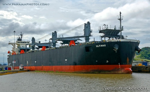
 ULTIMAX
Current Status
Where is the vessel?
ULTIMAX is currently in Open sea (no nearby ports in database), based on AIS data received less than 1h ago.
Latest AIS update:
Current position: 20.66955° S, 13.06270° W (Open sea (no nearby ports in database))
Average speed (last 7 days): Loading…
Average speed (last 30 days): Loading…
Vessel profile: ULTIMAX is a Wood Chips Carrier with dimensions 210m x 210m.
This page combines live AIS, route history, probable destination signals, nearby traffic, and port activity for practical vessel monitoring.
The current position of vessel ULTIMAX is -20.66955 lat / -13.06270 lng. Updated: 2026-03-30 02:06:23 UTCNearest reference points:
- Open sea (no nearby ports in database)
- Open sea, approx. 499 nm off the nearest listed port
- Open sea, approx. 490 nm off the nearest listed port
Currently sailing under the flag of Liberia ![]()
ULTIMAX built in 2006 year
Deadweight:
54347 tDetails:
Live Vessel ULTIMAX Analytics (details, animations, etc.)
Recent AIS points (UTC):
2026-03-29 19:28:03 UTC · -21.30393, -12.03362 · SOG 10.1 kn · COG 303°2026-03-29 21:39:02 UTC · -21.09689, -12.36895 · SOG 10.2 kn · COG 305°
2026-03-29 23:58:33 UTC · -20.87585, -12.73450 · SOG 10.5 kn · COG 305°
2026-03-30 02:06:23 UTC · -20.66955, -13.06270 · SOG 10.4 kn · COG 305°