 vesseltracker.com
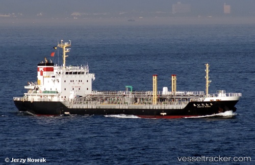
 Kintai Maru
Current Status
Where is the vessel?
Kintai Maru is currently in 13 nm NE of SAI, based on AIS data received about 1h ago.
Latest AIS update:
Current position: 41.57129° N, 141.09956° E (13 nm NE of SAI)
Average speed (last 7 days): Loading…
Average speed (last 30 days): Loading…
Vessel profile: Kintai Maru is a Oil Products Tanker with dimensions 105m x 16m.
This page combines live AIS, route history, probable destination signals, nearby traffic, and port activity for practical vessel monitoring.
The current position of vessel Kintai Maru is 41.57129 lat / 141.09956 lng. Updated: 2026-03-28 21:29:39 UTCNearest reference points:
- 23 nm NE of SAI
- 11 nm NW of Yokohama, Aomori
- Near Yokohama, Aomori
Currently sailing under the flag of Japan ![]()
Details:
Live Vessel Kintai Maru Analytics (details, animations, etc.)
Recent AIS points (UTC):
2026-03-28 16:10:27 UTC · 40.66122, 139.83234 · SOG 15.9 kn · COG 29°2026-03-28 17:36:21 UTC · 41.00176, 140.05531 · SOG 15.8 kn · COG 26°
2026-03-28 19:53:15 UTC · 41.44814, 140.60832 · SOG 17.1 kn · COG 50°
2026-03-28 21:29:39 UTC · 41.57129, 141.09956 · SOG 14.3 kn · COG 99°