 vesseltracker.com
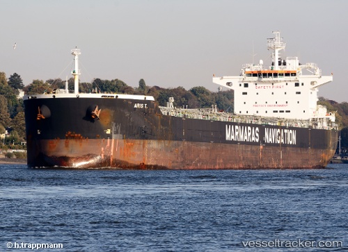
 ARIS T
Current Status
Where is the vessel?
ARIS T is currently in Near Waterport, based on AIS data received less than 1h ago.
Latest AIS update:
Current position: 36.14833° N, 5.29582° W (Near Waterport)
Average speed (last 7 days): Loading…
Average speed (last 30 days): Loading…
Vessel profile: ARIS T is a Bulk Carrier with dimensions m x m.
This page combines live AIS, route history, probable destination signals, nearby traffic, and port activity for practical vessel monitoring.
The current position of vessel ARIS T is 36.14833 lat / -5.29582 lng. Updated: 2026-04-02 11:24:46 UTCNearest reference points:
- Near Waterport
- Near La Línea de la Concepción
- Near Palmones
Currently sailing under the flag of Malta ![]()
Details:
Live Vessel ARIS T Analytics (details, animations, etc.)
Recent AIS points (UTC):
2026-04-02 05:45:45 UTC · 36.14544, -5.29709 · SOG 0 kn · COG 329°2026-04-02 08:00:45 UTC · 36.14529, -5.29967 · SOG 0.1 kn · COG 15°
2026-04-02 10:06:53 UTC · 36.14578, -5.29903 · SOG 0.2 kn · COG -1°
2026-04-02 11:24:46 UTC · 36.14833, -5.29582 · SOG 0.2 kn · COG 251°