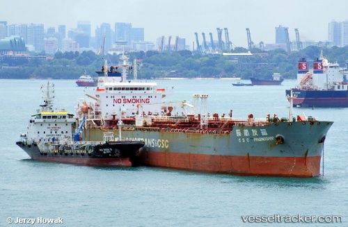
 SC SAPPHIRE
Current Status
Where is the vessel?
SC SAPPHIRE is currently in 107 nm W of Geraldton, based on AIS data received about 14h ago.
Latest AIS update:
Current position: 29.27334° S, 112.62085° E (107 nm W of Geraldton)
Average speed (last 7 days): Loading…
Average speed (last 30 days): Loading…
Vessel profile: SC SAPPHIRE is a Oil Products Tanker with dimensions m x m.
This page combines live AIS, route history, probable destination signals, nearby traffic, and port activity for practical vessel monitoring.
The current position of vessel SC SAPPHIRE is -29.27334 lat / 112.62085 lng. Updated: 2026-05-24 04:36:30 UTCNearest reference points:
- 45 nm W of Cataby
Currently sailing under the flag of Marshall Islands ![]()
Details:
Live Vessel SC SAPPHIRE Analytics (details, animations, etc.)
Recent AIS points (UTC):
2026-05-24 02:01:47 UTC · -28.82711, 112.44756 · SOG 11.3 kn · COG 157°2026-05-24 02:06:30 UTC · -28.84110, 112.45346 · SOG 11.4 kn · COG 156°
2026-05-24 03:24:14 UTC · -29.06692, 112.54669 · SOG 10.6 kn · COG 157°
2026-05-24 04:36:30 UTC · -29.27334, 112.62085 · SOG 10.7 kn · COG 158°