 vesseltracker.com
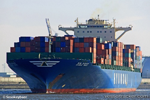
 Hyundai Brave
Current Status
Where is the vessel?
Hyundai Brave is currently in 25 nm SE of Port Edward, based on AIS data received less than 1h ago.
Latest AIS update:
Current position: 31.25623° S, 30.64552° E (25 nm SE of Port Edward)
Average speed (last 7 days): Loading…
Average speed (last 30 days): Loading…
Vessel profile: Hyundai Brave is a Container Ship with dimensions 339m x 45m.
This page combines live AIS, route history, probable destination signals, nearby traffic, and port activity for practical vessel monitoring.
The current position of vessel Hyundai Brave is -31.25623 lat / 30.64552 lng. Updated: 2026-04-02 15:39:36 UTCNearest reference points:
- 23 nm E of Port Saint John's
- Near Island View
- Near Durban
Currently sailing under the flag of Marshall Is ![]()
Hyundai Brave built in 2007 year
Deadweight:
99123 tDetails:
Live Vessel Hyundai Brave Analytics (details, animations, etc.)
Recent AIS points (UTC):
2026-04-02 09:46:33 UTC · -30.08838, 31.54122 · SOG 13.8 kn · COG 213°2026-04-02 12:15:00 UTC · -30.57482, 31.17198 · SOG 14.2 kn · COG 213°
2026-04-02 13:34:42 UTC · -30.83395, 30.95983 · SOG 14.2 kn · COG 213°
2026-04-02 15:39:36 UTC · -31.25623, 30.64552 · SOG 14.5 kn · COG 211°