 vesseltracker.com
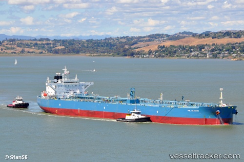
 MA JIN
Current Status
Where is the vessel?
MA JIN is currently in 57 nm SE of DONGJIAKOU, based on AIS data received about 2h ago.
Latest AIS update:
Current position: 35.06034° N, 120.75608° E (57 nm SE of DONGJIAKOU)
Average speed (last 7 days): Loading…
Average speed (last 30 days): Loading…
Vessel profile: MA JIN is a Crude Oil Tanker with dimensions m x m.
This page combines live AIS, route history, probable destination signals, nearby traffic, and port activity for practical vessel monitoring.
The current position of vessel MA JIN is 35.06034 lat / 120.75608 lng. Updated: 2026-04-12 13:11:17 UTCNearest reference points:
- 59 nm NE of CHENJIAGANG
- 62 nm NE of CHENJIAGANG
- 43 nm SE of DONGJIAKOU
Currently sailing under the flag of Sierra Leone ![]()
Details:
Live Vessel MA JIN Analytics (details, animations, etc.)
Recent AIS points (UTC):
2026-04-12 07:44:18 UTC · 35.05833, 120.75212 · SOG 0.1 kn · COG 32°2026-04-12 09:50:18 UTC · 35.05954, 120.75615 · SOG 0 kn · COG 261°
2026-04-12 11:26:24 UTC · 35.06005, 120.75603 · SOG 0 kn · COG 242°
2026-04-12 13:11:17 UTC · 35.06034, 120.75608 · SOG 0 kn · COG 239°