 vesseltracker.com
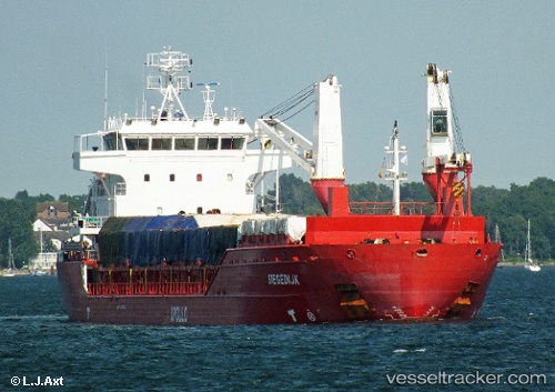
 DENIZ AKAY
Current Status
Where is the vessel?
DENIZ AKAY is currently in Near Fos-sur-Mer, based on AIS data received less than 1h ago.
Latest AIS update:
Current position: 43.42759° N, 4.89091° E (Near Fos-sur-Mer)
Average speed (last 7 days): Loading…
Average speed (last 30 days): Loading…
Vessel profile: DENIZ AKAY is a General Cargo with dimensions m x m.
This page combines live AIS, route history, probable destination signals, nearby traffic, and port activity for practical vessel monitoring.
The current position of vessel DENIZ AKAY is 43.42759 lat / 4.89091 lng. Updated: 2026-04-18 23:51:49 UTCNearest reference points:
- Near Fos-sur-Mer
- Near SAINT LOUIS DU RHONE
- Near Marseille
Currently sailing under the flag of Barbados ![]()
Details:
Live Vessel DENIZ AKAY Analytics (details, animations, etc.)
Recent AIS points (UTC):
2026-04-18 17:33:49 UTC · 43.42764, 4.89089 · SOG 0 kn · COG 247°2026-04-18 19:19:27 UTC · 43.42754, 4.89097 · SOG 0 kn · COG -1°
2026-04-18 21:42:43 UTC · 43.42764, 4.89091 · SOG 0 kn · COG 248°
2026-04-18 23:51:49 UTC · 43.42759, 4.89091 · SOG 0 kn · COG 248°