 vesseltracker.com
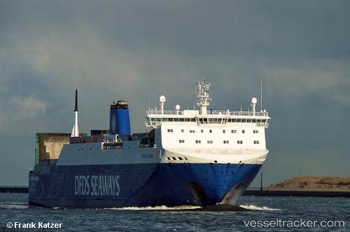
 CORONA SEA
Current Status
Where is the vessel?
CORONA SEA is currently in 24 nm SW of Kalana, based on AIS data received about 2h ago.
Latest AIS update:
Current position: 58.73200° N, 21.36904° E (24 nm SW of Kalana)
Average speed (last 7 days): Loading…
Average speed (last 30 days): Loading…
Vessel profile: CORONA SEA is a Vehicles Carrier with dimensions m x m.
This page combines live AIS, route history, probable destination signals, nearby traffic, and port activity for practical vessel monitoring.
The current position of vessel CORONA SEA is 58.73200 lat / 21.36904 lng. Updated: 2026-03-27 22:24:21 UTCNearest reference points:
- 20 nm W of Kalana
- 37 nm W of Vikati Sadam
- 18 nm N of Ventspils
Currently sailing under the flag of Portugal ![]()
Details:
Live Vessel CORONA SEA Analytics (details, animations, etc.)
Recent AIS points (UTC):
2026-03-27 15:37:45 UTC · 57.02128, 19.35728 · SOG 18.4 kn · COG 30°2026-03-27 18:09:33 UTC · 57.66435, 20.11162 · SOG 18 kn · COG 33°
2026-03-27 20:20:22 UTC · 58.21630, 20.75695 · SOG 17.7 kn · COG 31°
2026-03-27 22:24:21 UTC · 58.73200, 21.36904 · SOG 17.7 kn · COG 31°