 vesseltracker.com
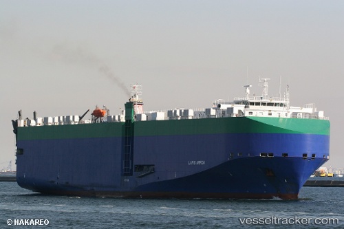
 Lapis Arrow
Current Status
Where is the vessel?
Lapis Arrow is currently in 41 nm SW of PUERTO MADERO, based on AIS data received about 2h ago.
Latest AIS update:
Current position: 14.14080° N, 92.79184° W (41 nm SW of PUERTO MADERO)
Average speed (last 7 days): Loading…
Average speed (last 30 days): Loading…
Vessel profile: Lapis Arrow is a Vehicles Carrier with dimensions 176m x 31m.
This page combines live AIS, route history, probable destination signals, nearby traffic, and port activity for practical vessel monitoring.
The current position of vessel Lapis Arrow is 14.14080 lat / -92.79184 lng. Updated: 2026-04-02 20:31:55 UTCNearest reference points:
- Near San Jose
Currently sailing under the flag of Bahamas ![]()
Details:
Live Vessel Lapis Arrow Analytics (details, animations, etc.)
Recent AIS points (UTC):
2026-04-02 15:27:41 UTC · 14.47277, -93.96475 · SOG 14.5 kn · COG 108°2026-04-02 17:03:36 UTC · 14.36750, -93.59415 · SOG 13.8 kn · COG 111°
2026-04-02 20:05:59 UTC · 14.16967, -92.89216 · SOG 14 kn · COG 108°
2026-04-02 20:31:55 UTC · 14.14080, -92.79184 · SOG 14 kn · COG 107°