 vesseltracker.com
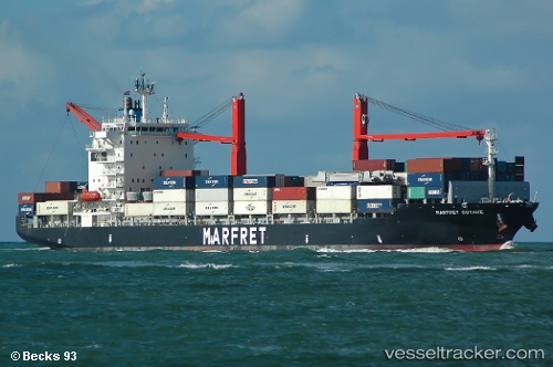
 MARFRET GUYANE
Current Status
Where is the vessel?
MARFRET GUYANE is currently in Near Barranquilla, based on AIS data received about 2h ago.
Latest AIS update:
Current position: 10.96867° N, 74.75866° W (Near Barranquilla)
Average speed (last 7 days): Loading…
Average speed (last 30 days): Loading…
Vessel profile: MARFRET GUYANE is a Container Ship with dimensions m x m.
This page combines live AIS, route history, probable destination signals, nearby traffic, and port activity for practical vessel monitoring.
The current position of vessel MARFRET GUYANE is 10.96867 lat / -74.75866 lng. Updated: 2026-04-10 04:16:31 UTCNearest reference points:
- Near Santa Marta
- 18 nm N of Santa Marta
- Near Contecar
Details:
Live Vessel MARFRET GUYANE Analytics (details, animations, etc.)
Recent AIS points (UTC):
2026-04-09 21:22:18 UTC · 10.96867, -74.75867 · SOG 0 kn · COG 178°2026-04-10 00:10:18 UTC · 10.96862, -74.75871 · SOG 0 kn · COG 178°
2026-04-10 02:19:28 UTC · 10.96863, -74.75871 · SOG 0.1 kn · COG 178°
2026-04-10 04:16:31 UTC · 10.96867, -74.75866 · SOG 0.1 kn · COG 178°