 vesseltracker.com
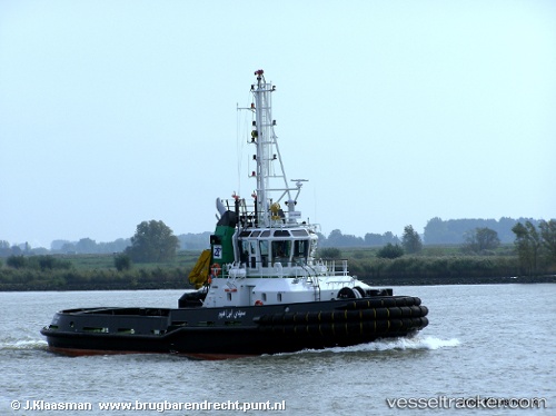
Sidi Brahim
Current StatusWhere is the vessel?
Sidi Brahim is currently in Near Annaba, based on AIS data received about 2d ago.
Latest AIS update:
Current position: 36.89915° N, 7.77081° E (Near Annaba)
Average speed (last 7 days): Loading…
Average speed (last 30 days): Loading…
Vessel profile: Sidi Brahim is a Tug with dimensions 10m x 31m.
This page combines live AIS, route history, probable destination signals, nearby traffic, and port activity for practical vessel monitoring.
The current position of vessel Sidi Brahim is 36.89915 lat / 7.77081 lng. Updated: 2026-04-10 03:17:09 UTCNearest reference points:
- Near Annaba
- Near Skikid
- 35 nm S of Setubal
Details:
Live Vessel Sidi Brahim Analytics (details, animations, etc.)
Recent AIS points (UTC):
2026-04-09 16:46:38 UTC · 36.90004, 7.77250 · SOG 6.4 kn · COG -1°2026-04-09 16:46:38 UTC · 36.90004, 7.77250 · SOG 6.4 kn · COG -1°
2026-04-10 03:17:09 UTC · 36.89915, 7.77081 · SOG 0.8 kn · COG -1°
2026-04-10 03:17:09 UTC · 36.89915, 7.77081 · SOG 0.8 kn · COG -1°