 vesseltracker.com
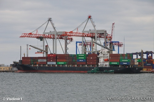
 TANTO NUSANTARA
Current Status
Where is the vessel?
TANTO NUSANTARA is currently in 15 nm NW of Tanjungbalai, based on AIS data received less than 1h ago.
Latest AIS update:
Current position: 1.21842° N, 103.30572° E (15 nm NW of Tanjungbalai)
Average speed (last 7 days): Loading…
Average speed (last 30 days): Loading…
Vessel profile: TANTO NUSANTARA is a Container Ship with dimensions m x m.
This page combines live AIS, route history, probable destination signals, nearby traffic, and port activity for practical vessel monitoring.
The current position of vessel TANTO NUSANTARA is 1.21842 lat / 103.30572 lng. Updated: 2026-04-01 03:35:36 UTCNearest reference points:
- Near Tanjungbalai
- 15 nm W of Tanjong Bin
- 19 nm W of Tanjong Bin
Currently sailing under the flag of Indonesia ![]()
Details:
Live Vessel TANTO NUSANTARA Analytics (details, animations, etc.)
Recent AIS points (UTC):
2026-03-31 21:43:55 UTC · 1.70452, 102.27954 · SOG 10.9 kn · COG 122°2026-03-31 23:21:36 UTC · 1.60722, 102.57055 · SOG 12.3 kn · COG 100°
2026-04-01 02:26:05 UTC · 1.25915, 103.08895 · SOG 12.1 kn · COG 124°
2026-04-01 03:35:36 UTC · 1.21842, 103.30572 · SOG 11.5 kn · COG 92°