 vesseltracker.com
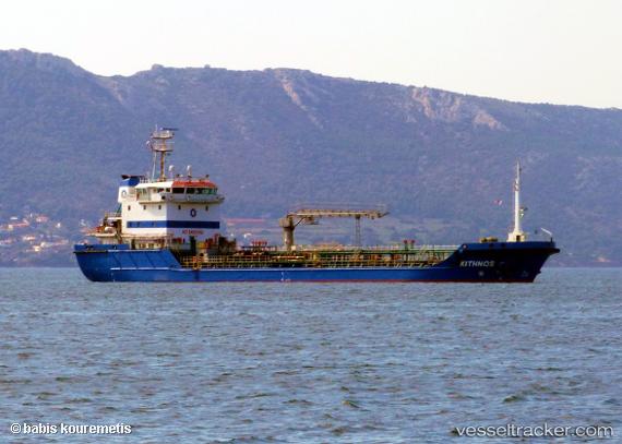
 ALAKAS I
Current Status
Where is the vessel?
ALAKAS I is currently in 15 nm SW of Douala, based on AIS data received about 1h ago.
Latest AIS update:
Current position: 3.87161° N, 9.50248° E (15 nm SW of Douala)
Average speed (last 7 days): Loading…
Average speed (last 30 days): Loading…
Vessel profile: ALAKAS I is a Oil Products Tanker with dimensions m x m.
This page combines live AIS, route history, probable destination signals, nearby traffic, and port activity for practical vessel monitoring.
The current position of vessel ALAKAS I is 3.87161 lat / 9.50248 lng. Updated: 2026-04-15 11:29:07 UTCNearest reference points:
- Near Victoria
- Near Moudi Terminal
- Near Calabar
Currently sailing under the flag of Bahamas ![]()
Details:
Live Vessel ALAKAS I Analytics (details, animations, etc.)
Recent AIS points (UTC):
2026-04-15 05:02:00 UTC · 3.87003, 9.50078 · SOG 0 kn · COG 45°2026-04-15 07:20:05 UTC · 3.87091, 9.49926 · SOG 0 kn · COG 50°
2026-04-15 09:56:10 UTC · 3.86833, 9.49833 · SOG 0 kn · COG -1°
2026-04-15 11:29:07 UTC · 3.87161, 9.50248 · SOG 0.6 kn · COG 216°