 vesseltracker.com
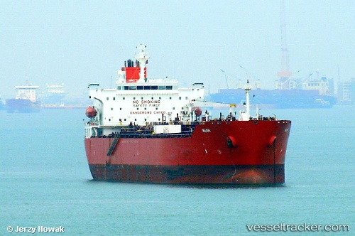
 KASHI
KASHI
Current Status
Where is the vessel?
KASHI is currently in Near BUKOM ISLAND, based on AIS data received less than 1h ago.
Latest AIS update:
Current position: 1.16355° N, 103.71485° E (Near BUKOM ISLAND)
Average speed (last 7 days): Loading…
Average speed (last 30 days): Loading…
Vessel profile: KASHI is a Chemical/Oil Products Tanker with dimensions 183m x 32m.
This page combines live AIS, route history, probable destination signals, nearby traffic, and port activity for practical vessel monitoring.
The current position of vessel KASHI is 1.16355 lat / 103.71485 lng. Updated: 2026-03-31 18:00:13 UTCNearest reference points:
- Near BUKOM ISLAND
- Near JURONG ISLAND
- Near Pulau Ayer Chawan
Currently sailing under the flag of India ![]()
KASHI built in 2006 year
Deadweight:
46159 tDetails:
Live Vessel KASHI Analytics (details, animations, etc.)
Recent AIS points (UTC):
2026-03-31 12:19:00 UTC · 1.16507, 103.71412 · SOG 0.1 kn · COG -1°2026-03-31 14:06:06 UTC · 1.16450, 103.71423 · SOG 0 kn · COG 89°
2026-03-31 15:45:06 UTC · 1.16355, 103.71463 · SOG 0.1 kn · COG 37°
2026-03-31 18:00:13 UTC · 1.16355, 103.71485 · SOG 0.1 kn · COG 34°