 vesseltracker.com
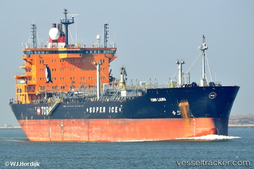
 Torm Laura
Current Status
Where is the vessel?
Torm Laura is currently in 45 nm NE of Harbour Island, based on AIS data received about 1h ago.
Latest AIS update:
Current position: 25.81292° N, 75.87530° W (45 nm NE of Harbour Island)
Average speed (last 7 days): Loading…
Average speed (last 30 days): Loading…
Vessel profile: Torm Laura is a Chemical Oil Products Tanker with dimensions 183m x 32m.
This page combines live AIS, route history, probable destination signals, nearby traffic, and port activity for practical vessel monitoring.
The current position of vessel Torm Laura is 25.81292 lat / -75.87530 lng. Updated: 2026-03-29 09:56:33 UTCNearest reference points:
- 31 nm E of Harbour Island
- 22 nm E of Harbour Island
- Near Harbour Island
Currently sailing under the flag of Denmark ![]()
Torm Laura built in 2008 year
Deadweight:
53160 tDetails:
Live Vessel Torm Laura Analytics (details, animations, etc.)
Recent AIS points (UTC):
2026-03-29 03:21:28 UTC · 26.08154, -74.20629 · SOG 14.5 kn · COG 264°2026-03-29 05:33:52 UTC · 26.01267, -74.79021 · SOG 14.2 kn · COG 257°
2026-03-29 07:16:45 UTC · 25.94030, -75.25098 · SOG 14.9 kn · COG 257°
2026-03-29 09:56:33 UTC · 25.81292, -75.87530 · SOG 10.8 kn · COG 263°