 vesseltracker.com
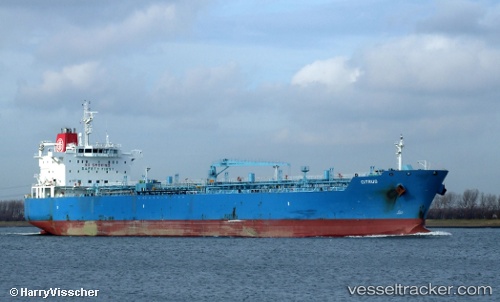
 SEA LA BELLE
Current Status
Where is the vessel?
SEA LA BELLE is currently in 53 nm S of LAS MAREAS, based on AIS data received about 22h ago.
Latest AIS update:
Current position: 17.09833° N, 65.86167° W (53 nm S of LAS MAREAS)
Average speed (last 7 days): Loading…
Average speed (last 30 days): Loading…
Vessel profile: SEA LA BELLE is a Oil/Chemical Tanker with dimensions m x m.
This page combines live AIS, route history, probable destination signals, nearby traffic, and port activity for practical vessel monitoring.
The current position of vessel SEA LA BELLE is 17.09833 lat / -65.86167 lng. Updated: 2026-04-10 07:43:44 UTCNearest reference points:
- 82 nm S of Santa Isabel
- Near Isabel Segunda
- Near Frederiksted
Currently sailing under the flag of Liberia ![]()
Details:
Live Vessel SEA LA BELLE Analytics (details, animations, etc.)
Recent AIS points (UTC):
2026-04-10 01:25:43 UTC · 17.57500, -64.78667 · SOG 11 kn · COG -1°2026-04-10 03:46:43 UTC · 17.25667, -65.14167 · SOG 11 kn · COG -1°
2026-04-10 05:22:44 UTC · 17.08167, -65.40667 · SOG 9 kn · COG -1°
2026-04-10 07:43:44 UTC · 17.09833, -65.86167 · SOG 11 kn · COG -1°