 vesseltracker.com
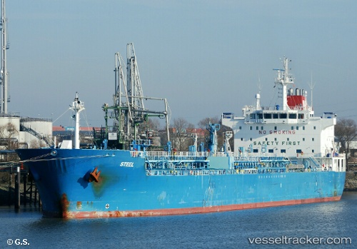
 STEEL
STEEL
Current Status
Where is the vessel?
STEEL is currently in Near Freeport, based on AIS data received less than 1h ago.
Latest AIS update:
Current position: 26.52124° N, 78.76660° W (Near Freeport)
Average speed (last 7 days): Loading…
Average speed (last 30 days): Loading…
Vessel profile: STEEL is a Chemical/Oil Products Tanker with dimensions 184m x 184m.
This page combines live AIS, route history, probable destination signals, nearby traffic, and port activity for practical vessel monitoring.
The current position of vessel STEEL is 26.52124 lat / -78.76660 lng. Updated: 2026-04-02 15:56:12 UTCNearest reference points:
- 44 nm S of Freeport
- 44 nm E of Surfside
- Near Palm Beach
Currently sailing under the flag of Marshall Islands ![]()
STEEL built in 2008 year
Deadweight:
37538 tDetails:
Live Vessel STEEL Analytics (details, animations, etc.)
Recent AIS points (UTC):
2026-04-02 09:53:13 UTC · 26.52120, -78.76662 · SOG 0 kn · COG 307°2026-04-02 12:17:06 UTC · 26.52122, -78.76659 · SOG 0 kn · COG 307°
2026-04-02 14:08:08 UTC · 26.52126, -78.76663 · SOG 0 kn · COG 306°
2026-04-02 15:56:12 UTC · 26.52124, -78.76660 · SOG 0 kn · COG 306°