 vesseltracker.com
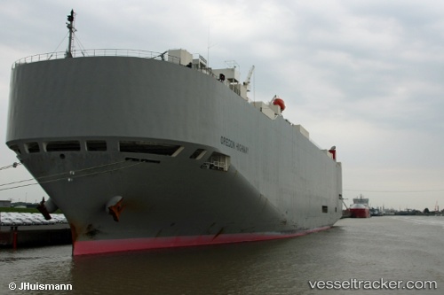
Oregon Highway
Current StatusWhere is the vessel?
Oregon Highway is currently in Near Choa Chu Kang, based on AIS data received about 1h ago.
Latest AIS update:
Current position: 1.27446° N, 103.90324° E (Near Choa Chu Kang)
Average speed (last 7 days): Loading…
Average speed (last 30 days): Loading…
Vessel profile: Oregon Highway is a Vehicles Carrier with dimensions 32m x 199m.
This page combines live AIS, route history, probable destination signals, nearby traffic, and port activity for practical vessel monitoring.
The current position of vessel Oregon Highway is 1.27446 lat / 103.90324 lng. Updated: 2026-03-28 15:55:13 UTCNearest reference points:
- Near Choa Chu Kang
- Near Tampines
- Near Changi
Details:
Live Vessel Oregon Highway Analytics (details, animations, etc.)
Recent AIS points (UTC):
2026-03-28 10:22:13 UTC · 1.27470, 103.90311 · SOG 0 kn · COG 55°2026-03-28 12:16:50 UTC · 1.27450, 103.90319 · SOG 0 kn · COG -1°
2026-03-28 13:52:24 UTC · 1.27453, 103.90316 · SOG 0 kn · COG 54°
2026-03-28 15:55:13 UTC · 1.27446, 103.90324 · SOG 0 kn · COG 58°