 vesseltracker.com
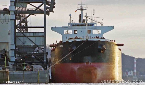
 CORONA
Current Status
Where is the vessel?
CORONA is currently in 48 nm S of Contai, based on AIS data received about 2h ago.
Latest AIS update:
Current position: 20.98757° N, 87.95588° E (48 nm S of Contai)
Average speed (last 7 days): Loading…
Average speed (last 30 days): Loading…
Vessel profile: CORONA is a Bulk Carrier with dimensions m x m.
This page combines live AIS, route history, probable destination signals, nearby traffic, and port activity for practical vessel monitoring.
The current position of vessel CORONA is 20.98757 lat / 87.95588 lng. Updated: 2026-04-12 17:29:26 UTCNearest reference points:
- 45 nm S of Contai
- 61 nm E of DHAMRA
- 56 nm SE of Contai
Currently sailing under the flag of Portugal ![]()
Details:
Live Vessel CORONA Analytics (details, animations, etc.)
Recent AIS points (UTC):
2026-04-12 11:41:26 UTC · 20.98899, 87.95440 · SOG 0.1 kn · COG 192°2026-04-12 13:42:16 UTC · 20.98835, 87.95547 · SOG 0 kn · COG -1°
2026-04-12 15:20:21 UTC · 20.98882, 87.95537 · SOG 0.1 kn · COG 226°
2026-04-12 17:29:26 UTC · 20.98757, 87.95588 · SOG 0.4 kn · COG 269°