 vesseltracker.com
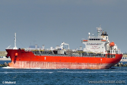
 VAST CORAL
Current Status
Where is the vessel?
VAST CORAL is currently in 19 nm E of PANAREA, based on AIS data received about 1h ago.
Latest AIS update:
Current position: 38.61040° N, 15.49107° E (19 nm E of PANAREA)
Average speed (last 7 days): Loading…
Average speed (last 30 days): Loading…
Vessel profile: VAST CORAL is a Oil/Chemical Tanker with dimensions m x m.
This page combines live AIS, route history, probable destination signals, nearby traffic, and port activity for practical vessel monitoring.
The current position of vessel VAST CORAL is 38.61040 lat / 15.49107 lng. Updated: 2026-03-26 22:15:54 UTCNearest reference points:
- 13 nm N of Rometta Marea
- Near Tropea
- Near Torre Faro
Currently sailing under the flag of Marshall Islands ![]()
Details:
Live Vessel VAST CORAL Analytics (details, animations, etc.)
Recent AIS points (UTC):
2026-03-26 15:46:35 UTC · 39.71950, 14.72313 · SOG 11.3 kn · COG 156°2026-03-26 17:28:02 UTC · 39.45852, 14.96283 · SOG 10.8 kn · COG 156°
2026-03-26 19:22:24 UTC · 39.14798, 15.20423 · SOG 11.3 kn · COG 155°
2026-03-26 22:15:54 UTC · 38.61040, 15.49107 · SOG 12.4 kn · COG 156°