 vesseltracker.com
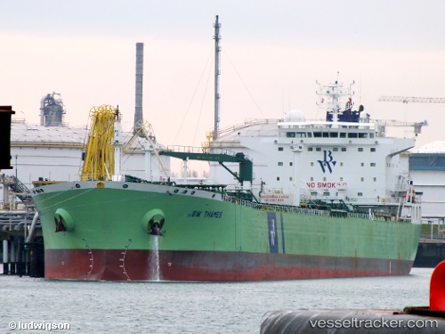
 BAM BAM
Current Status
Where is the vessel?
BAM BAM is currently in 34 nm SW of Palinuro, based on AIS data received about 3h ago.
Latest AIS update:
Current position: 39.57308° N, 14.86186° E (34 nm SW of Palinuro)
Average speed (last 7 days): Loading…
Average speed (last 30 days): Loading…
Vessel profile: BAM BAM is a Oil Products Tanker with dimensions m x m.
This page combines live AIS, route history, probable destination signals, nearby traffic, and port activity for practical vessel monitoring.
The current position of vessel BAM BAM is 39.57308 lat / 14.86186 lng. Updated: 2026-04-10 07:24:48 UTCNearest reference points:
- Near Praia a Mare
- 10 nm W of Paola
- Near Salerno
Currently sailing under the flag of Liberia ![]()
Details:
Live Vessel BAM BAM Analytics (details, animations, etc.)
Recent AIS points (UTC):
2026-04-10 02:27:59 UTC · 39.59701, 14.86920 · SOG 10.7 kn · COG 222°2026-04-10 03:48:38 UTC · 39.54273, 14.84668 · SOG 0 kn · COG 205°
2026-04-10 06:01:28 UTC · 39.55691, 14.85282 · SOG 0.6 kn · COG 193°
2026-04-10 07:24:48 UTC · 39.57308, 14.86186 · SOG 0.8 kn · COG 274°