 vesseltracker.com
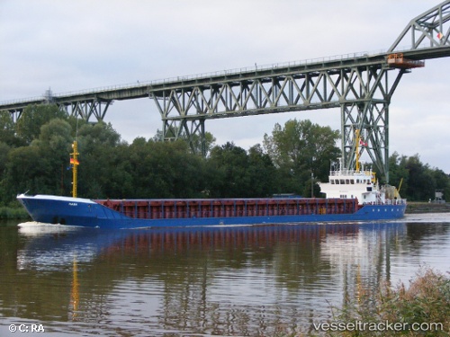
 GMS MANA
Current Status
Where is the vessel?
GMS MANA is currently in Near RAS LAFFAN, based on AIS data received less than 1h ago.
Latest AIS update:
Current position: 25.82395° N, 51.64008° E (Near RAS LAFFAN)
Average speed (last 7 days): Loading…
Average speed (last 30 days): Loading…
Vessel profile: GMS MANA is a Multi Purpose Offshore Vessel with dimensions m x m.
This page combines live AIS, route history, probable destination signals, nearby traffic, and port activity for practical vessel monitoring.
The current position of vessel GMS MANA is 25.82395 lat / 51.64008 lng. Updated: 2026-04-03 00:15:24 UTCNearest reference points:
- Near RAS LAFFAN
- Near KHALIFA BIN SALMAN
- Near Sitrah Anchorage
Currently sailing under the flag of Liberia ![]()
Details:
Live Vessel GMS MANA Analytics (details, animations, etc.)
Recent AIS points (UTC):
2026-04-02 17:35:23 UTC · 25.92450, 51.59804 · SOG 0 kn · COG -1°2026-04-02 19:29:59 UTC · 25.88851, 51.67675 · SOG 7.3 kn · COG 163°
2026-04-02 22:12:42 UTC · 25.82386, 51.64004 · SOG 1.2 kn · COG -1°
2026-04-03 00:15:24 UTC · 25.82395, 51.64008 · SOG 0.3 kn · COG -1°