 vesseltracker.com
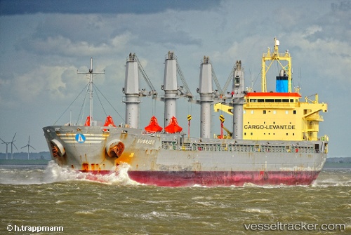
 LUCKY FINDER
Current Status
Where is the vessel?
LUCKY FINDER is currently in 82 nm NE of Pinelands, based on AIS data received about 1h ago.
Latest AIS update:
Current position: 34.57383° N, 19.94063° E (82 nm NE of Pinelands)
Average speed (last 7 days): Loading…
Average speed (last 30 days): Loading…
Vessel profile: LUCKY FINDER is a Bulk Carrier with dimensions m x m.
This page combines live AIS, route history, probable destination signals, nearby traffic, and port activity for practical vessel monitoring.
The current position of vessel LUCKY FINDER is 34.57383 lat / 19.94063 lng. Updated: 2026-03-29 04:14:45 UTCNearest reference points:
- 61 nm N of Al Marj
- 71 nm N of Pinelands
- 73 nm N of Pinelands
Currently sailing under the flag of Marshall Islands ![]()
Details:
Live Vessel LUCKY FINDER Analytics (details, animations, etc.)
Recent AIS points (UTC):
2026-03-28 21:12:53 UTC · 34.91152, 18.50514 · SOG 11.6 kn · COG 107°2026-03-28 23:43:43 UTC · 34.76870, 19.09862 · SOG 12.9 kn · COG 106°
2026-03-28 23:43:43 UTC · 34.76870, 19.09862 · SOG 12.9 kn · COG 106°
2026-03-29 04:14:45 UTC · 34.57383, 19.94063 · SOG 12 kn · COG 106°