 vesseltracker.com
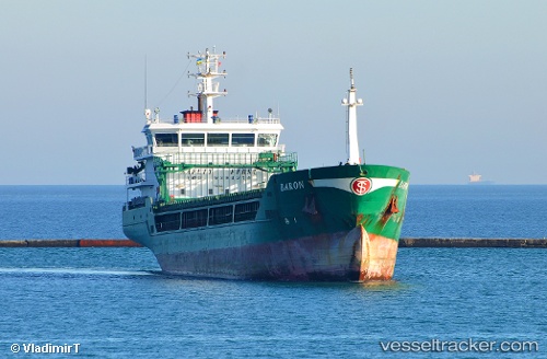
 BARON
BARON
Current Status
Where is the vessel?
BARON is currently in 19 nm N of Ain Taya, based on AIS data received less than 1h ago.
Latest AIS update:
Current position: 37.10334° N, 3.28632° E (19 nm N of Ain Taya)
Average speed (last 7 days): Loading…
Average speed (last 30 days): Loading…
Vessel profile: BARON is a General Cargo with dimensions m x m.
This page combines live AIS, route history, probable destination signals, nearby traffic, and port activity for practical vessel monitoring.
The current position of vessel BARON is 37.10334 lat / 3.28632 lng. Updated: 2026-04-01 17:28:09 UTCNearest reference points:
- 16 nm NE of Berja
- Near Algiers
- Near Zamoranos
Currently sailing under the flag of Marshall Islands ![]()
Details:
Live Vessel BARON Analytics (details, animations, etc.)
Recent AIS points (UTC):
2026-04-01 11:47:39 UTC · 36.95886, 2.33916 · SOG 7.1 kn · COG -1°2026-04-01 13:52:45 UTC · 36.99500, 2.66667 · SOG 7 kn · COG -1°
2026-04-01 15:25:02 UTC · 37.03782, 2.92653 · SOG 8.2 kn · COG 75°
2026-04-01 17:28:09 UTC · 37.10334, 3.28632 · SOG 9.3 kn · COG -1°