 vesseltracker.com
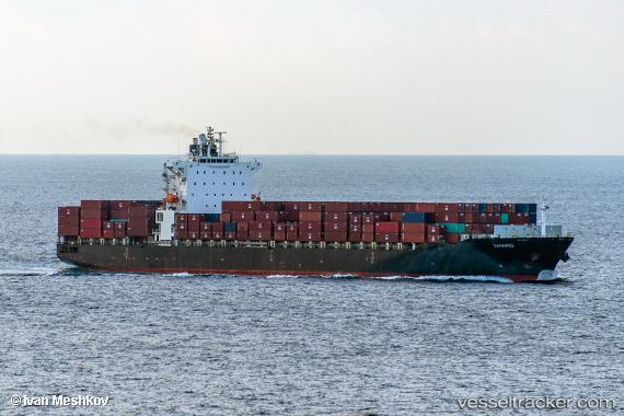
 BAHAMAS
Current Status
Where is the vessel?
BAHAMAS is currently in Near TANAH MERAH, based on AIS data received about 1h ago.
Latest AIS update:
Current position: 1.24865° N, 104.09064° E (Near TANAH MERAH)
Average speed (last 7 days): Loading…
Average speed (last 30 days): Loading…
Vessel profile: BAHAMAS is a Container Ship with dimensions 259m x 32m.
This page combines live AIS, route history, probable destination signals, nearby traffic, and port activity for practical vessel monitoring.
The current position of vessel BAHAMAS is 1.24865 lat / 104.09064 lng. Updated: 2026-04-14 05:48:24 UTCNearest reference points:
- Near TANAH MERAH
- Near BATU AMPAR
- Near PENGERANG
Currently sailing under the flag of Liberia ![]()
BAHAMAS built in 2010 year
Deadweight:
52173 tDetails:
Live Vessel BAHAMAS Analytics (details, animations, etc.)
Recent AIS points (UTC):
2026-04-13 23:43:40 UTC · 1.68079, 102.69266 · SOG 16.1 kn · COG 116°2026-04-14 01:41:21 UTC · 1.41275, 103.15348 · SOG 16.2 kn · COG 117°
2026-04-14 03:24:28 UTC · 1.11980, 103.51521 · SOG 16.6 kn · COG 126°
2026-04-14 05:48:24 UTC · 1.24865, 104.09064 · SOG 16.6 kn · COG 88°