 vesseltracker.com
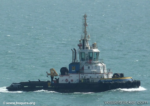
 SL AFRICA
Current Status
Where is the vessel?
SL AFRICA is currently in Near Cabinda, based on AIS data received about 1d ago.
Latest AIS update:
Current position: 5.53014° S, 12.02743° E (Near Cabinda)
Average speed (last 7 days): Loading…
Average speed (last 30 days): Loading…
Vessel profile: SL AFRICA is a Tug with dimensions 24m x 40m.
This page combines live AIS, route history, probable destination signals, nearby traffic, and port activity for practical vessel monitoring.
The current position of vessel SL AFRICA is -5.53014 lat / 12.02743 lng. Updated: 2026-04-10 07:25:11 UTCNearest reference points:
- 11 nm W of Cabinda
- Near Futila Terminal
- Near N'Kossa Terminal
Currently sailing under the flag of Cyprus ![]()
SL AFRICA built in 2007 year
Deadweight:
0 tDetails:
Live Vessel SL AFRICA Analytics (details, animations, etc.)
Recent AIS points (UTC):
2026-04-10 02:26:53 UTC · -5.53018, 12.02548 · SOG 0.1 kn · COG -1°2026-04-10 03:47:54 UTC · -5.53013, 12.02587 · SOG 0.1 kn · COG -1°
2026-04-10 05:47:13 UTC · -5.53010, 12.02685 · SOG 0 kn · COG 188°
2026-04-10 07:25:11 UTC · -5.53014, 12.02743 · SOG 0 kn · COG -1°