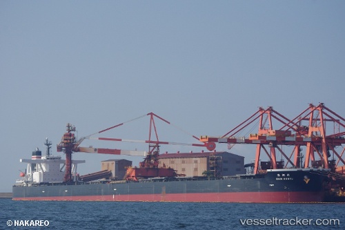
.
Vessel photo of Shin Koryu (IMO 9398149) vesseltracker.com

Shin Koryu

Vessel type: Ore Carrier | IMO: 9398149 | MMSI: MMSI: 356849000
Call sign: 3FSQ3 | Dimensions: 50 m x 300 m
Current Status

Where is the vessel?

Shin Koryu is currently in 74 nm NW of Hongdo, based on AIS data received less than 1h ago.

Latest AIS update:

Current position: 35.31316° N, 123.91121° E (74 nm NW of Hongdo)

Average speed (last 7 days): Loading…

Average speed (last 30 days): Loading…

Vessel profile: Shin Koryu is a Ore Carrier with dimensions 50m x 300m.

This page combines live AIS, route history, probable destination signals, nearby traffic, and port activity for practical vessel monitoring.

The current position of vessel Shin Koryu is 35.31316 lat / 123.91121 lng. Updated: 2026-03-29 22:04:36 UTC
Nearest reference points:
  • 77 nm W of Hongdo
  • 78 nm SE of Shidao Pt
  • 83 nm SE of Shidao Pt
Details:

Live Vessel Shin Koryu Analytics (details, animations, etc.)


Recent AIS points (UTC):
2026-03-29 16:00:06 UTC · 36.52332, 123.86768 · SOG 12.3 kn · COG 190°
2026-03-29 17:38:58 UTC · 36.21833, 123.89333 · SOG 11 kn · COG -1°
2026-03-29 19:51:55 UTC · 35.78047, 123.92499 · SOG 12.5 kn · COG 176°
2026-03-29 22:04:36 UTC · 35.31316, 123.91121 · SOG 12.9 kn · COG 205°

Track of the vessel in the last 28 days


UTC: --
Start: -- Track timeline (UTC) End: --
Encountered: --


Link to the map:


Find another ship

Shin_Koryu (356849000) last ports (portcalls and passsages)

BAKAUHENI | 2025-08-30 06:21:48
Yen-Tai | 2025-08-16 11:47:30
PENGERANG | 2025-07-30 09:23:05
TANAH MERAH | 2025-07-30 07:48:01
BATU AMPAR | 2025-07-30 07:19:58
PULAU SAMBU | 2025-07-30 06:13:31
JURONG ISLAND | 2025-05-08 04:42:35
BATU AMPAR | 2025-05-08 02:35:34
TANAH MERAH | 2025-05-07 12:49:23
PENGERANG | 2025-05-07 11:17:03
Yen-Tai | 2025-04-24 08:41:30
BAKAUHENI | 2025-03-31 13:18:16
BUKOM ISLAND | 2025-01-07 11:57:10
PULAU SAMBU | 2025-01-07 11:19:40
TANAH MERAH | 2025-01-05 23:37:55
PENGERANG | 2025-01-05 22:06:36
Yen-Tai | 2024-12-26 12:19:10
Yen-Tai | 2024-12-22 12:07:20
PENGERANG | 2024-12-02 23:23:50
TANAH MERAH | 2024-12-02 22:04:42
PULAU SAMBU | 2024-12-02 20:47:00
Sambu | 2024-09-20 03:24:57
Rizhao | 2024-04-30 14:34:20
Rizhao | 2024-04-26 13:57:10
Selat Sunda | 2024-01-13 19:46:23
Map Ta Phut | 2024-01-08 02:22:13
Map Ta Phut | 2024-01-04 02:18:18
Newcastle | 2023-12-14 06:38:36
Singapore | 2023-11-03 20:41:28
Imabari | 2023-08-11 01:57:49
Samson Point | 2023-07-20 22:50:45
Samson Point | 2023-07-16 21:50:24
Samson Point | 2023-07-12 20:58:20
Imabari | 2023-07-02 01:38:11
Matsuga-hana | 2023-06-21 00:39:41
Samson Point | 2023-06-04 22:07:21
Samson Point | 2023-05-31 21:16:22
Samson Point | 2023-05-27 20:57:05
Taicang | 2023-05-14 14:32:23
Wusong | 2023-05-14 12:24:56
Taku Bar | 2023-05-08 06:12:35
Port Headland | 2023-04-20 06:07:41
Uno | 2023-01-21 23:03:01
Port Headland | 2023-01-05 15:02:44
Port Headland | 2022-11-16 17:35:25
Samson Point | 2022-10-04 01:33:23
Selat Lombok | 2022-07-22 16:09:52
Port Headland | 2022-07-18 16:57:14
Selat Lombok | 2022-07-14 01:16:23
Yokosuka | 2022-06-20 01:20:11
Yokohama | 2022-06-18 01:23:00
Kawasaki | 2022-06-16 04:53:08
Singapore | 2022-05-29 02:00:25
Port Louis | 2022-05-14 10:23:04
Sao Luiz | 2022-04-13 08:57:02
Sambu | 2022-01-14 03:00:51
Singapore | 2022-01-14 02:35:51
Sambu | 2022-01-14 02:00:15