 vesseltracker.com
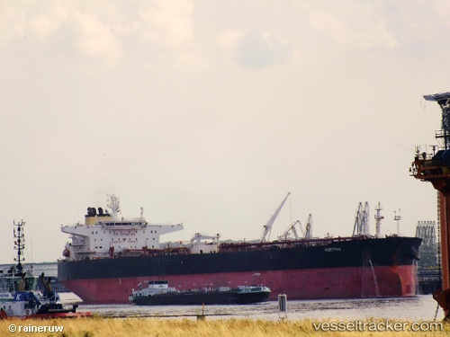
 LLEVANT
Current Status
Where is the vessel?
LLEVANT is currently in 12 nm S of Kumport, based on AIS data received about 1h ago.
Latest AIS update:
Current position: 40.75275° N, 28.77709° E (12 nm S of Kumport)
Average speed (last 7 days): Loading…
Average speed (last 30 days): Loading…
Vessel profile: LLEVANT is a Crude Oil Tanker with dimensions m x m.
This page combines live AIS, route history, probable destination signals, nearby traffic, and port activity for practical vessel monitoring.
The current position of vessel LLEVANT is 40.75275 lat / 28.77709 lng. Updated: 2026-04-22 09:26:06 UTCNearest reference points:
- 16 nm S of Kumport
- 17 nm S of Kumport
- Near Kumport
Currently sailing under the flag of Panama ![]()
Details:
Live Vessel LLEVANT Analytics (details, animations, etc.)
Recent AIS points (UTC):
2026-04-22 05:57:45 UTC · 40.73490, 28.88509 · SOG 1.6 kn · COG 290°2026-04-22 07:05:45 UTC · 40.73359, 28.86341 · SOG 0.4 kn · COG 334°
2026-04-22 08:03:55 UTC · 40.72964, 28.85496 · SOG 1.2 kn · COG 318°
2026-04-22 09:26:06 UTC · 40.75275, 28.77709 · SOG 1 kn · COG 326°