 vesseltracker.com
 DOLE WARI
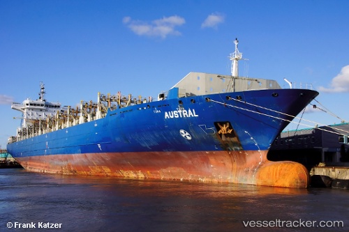
Current Status
Where is the vessel?
DOLE WARI is currently in 28 nm N of Isleta, based on AIS data received less than 1h ago.
Latest AIS update:
Current position: 16.01965° N, 86.02942° W (28 nm N of Isleta)
Average speed (last 7 days): Loading…
Average speed (last 30 days): Loading…
Vessel profile: DOLE WARI is a Container Ship with dimensions m x m.
This page combines live AIS, route history, probable destination signals, nearby traffic, and port activity for practical vessel monitoring.
The current position of vessel DOLE WARI is 16.01965 lat / -86.02942 lng. Updated: 2026-04-06 14:06:03 UTCNearest reference points:
- 26 nm SE of Dangriga
- 14 nm NW of Puerto Cortes
- 14 nm SE of Belize
Currently sailing under the flag of Bahamas ![]()
Details:
Live Vessel DOLE WARI Analytics (details, animations, etc.)
Recent AIS points (UTC):
2026-04-06 01:55:32 UTC · 15.40288, -82.60125 · SOG 17.5 kn · COG 308°2026-04-06 08:04:54 UTC · 15.94551, -84.35876 · SOG 17.5 kn · COG 283°
2026-04-06 08:04:54 UTC · 15.94551, -84.35876 · SOG 17.5 kn · COG 283°
2026-04-06 14:06:03 UTC · 16.01965, -86.02942 · SOG 8.7 kn · COG 198°