 vesseltracker.com
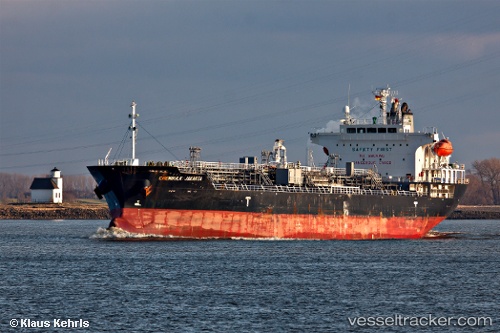
 ORIONIS
Current Status
Where is the vessel?
ORIONIS is currently in 161 nm E of SAO LUIS, based on AIS data received about 15h ago.
Latest AIS update:
Current position: 0.38112° N, 2.64965° E (161 nm E of SAO LUIS)
Average speed (last 7 days): Loading…
Average speed (last 30 days): Loading…
Vessel profile: ORIONIS is a Oil/Chemical Tanker with dimensions m x m.
This page combines live AIS, route history, probable destination signals, nearby traffic, and port activity for practical vessel monitoring.
The current position of vessel ORIONIS is 0.38112 lat / 2.64965 lng. Updated: 2026-04-10 07:00:17 UTCNearest reference points:
- 138 nm E of SAO LUIS
- 66 nm N of SAO LUIS
Currently sailing under the flag of Marshall Islands ![]()
Details:
Live Vessel ORIONIS Analytics (details, animations, etc.)
Recent AIS points (UTC):
2026-04-10 02:27:00 UTC · -0.59667, 2.78000 · SOG 13 kn · COG -1°2026-04-10 03:46:55 UTC · -0.31022, 2.74730 · SOG 12.9 kn · COG 350°
2026-04-10 05:49:10 UTC · 0.12667, 2.68167 · SOG 12 kn · COG -1°
2026-04-10 07:00:17 UTC · 0.38112, 2.64965 · SOG 13 kn · COG 353°