 vesseltracker.com
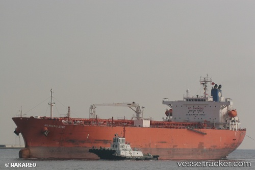
 St. Gertrud
Current Status
Where is the vessel?
St. Gertrud is currently in Near Cotonou, based on AIS data received less than 1h ago.
Latest AIS update:
Current position: 6.26838° N, 2.53525° E (Near Cotonou)
Average speed (last 7 days): Loading…
Average speed (last 30 days): Loading…
Vessel profile: St. Gertrud is a Oil Products Tanker with dimensions 180m x 32m.
This page combines live AIS, route history, probable destination signals, nearby traffic, and port activity for practical vessel monitoring.
The current position of vessel St. Gertrud is 6.26838 lat / 2.53525 lng. Updated: 2026-04-12 13:25:44 UTCNearest reference points:
- Near Cotonou
- Near Kirikiri
- Near Apapa
Currently sailing under the flag of Panama ![]()
St. Gertrud built in 2009 year
Deadweight:
46622 tDetails:
Live Vessel St. Gertrud Analytics (details, animations, etc.)
Recent AIS points (UTC):
2026-04-12 08:04:41 UTC · 6.26922, 2.53467 · SOG 0.1 kn · COG 225°2026-04-12 10:43:43 UTC · 6.26905, 2.53487 · SOG 0 kn · COG 235°
2026-04-12 11:52:44 UTC · 6.26890, 2.53498 · SOG 0.1 kn · COG 242°
2026-04-12 13:25:44 UTC · 6.26838, 2.53525 · SOG 0 kn · COG 260°