 vesseltracker.com
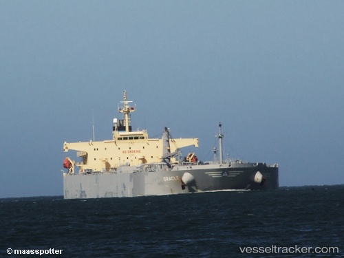
 EVALI
EVALI
Current Status
Where is the vessel?
EVALI is currently in 21 nm E of Dalian, based on AIS data received about 1d ago.
Latest AIS update:
Current position: 38.81365° N, 122.06852° E (21 nm E of Dalian)
Average speed (last 7 days): Loading…
Average speed (last 30 days): Loading…
Vessel profile: EVALI is a Crude Oil Tanker with dimensions m x m.
This page combines live AIS, route history, probable destination signals, nearby traffic, and port activity for practical vessel monitoring.
The current position of vessel EVALI is 38.81365 lat / 122.06852 lng. Updated: 2026-04-10 08:21:49 UTCNearest reference points:
- 22 nm SE of Dalian
- 20 nm E of Dalian
- 15 nm E of Dalian
Currently sailing under the flag of Comoros ![]()
Details:
Live Vessel EVALI Analytics (details, animations, etc.)
Recent AIS points (UTC):
2026-04-10 01:48:48 UTC · 38.81515, 122.07252 · SOG 0.1 kn · COG 254°2026-04-10 03:51:49 UTC · 38.81485, 122.07275 · SOG 0.2 kn · COG 256°
2026-04-10 05:39:47 UTC · 38.81448, 122.07268 · SOG 0 kn · COG 287°
2026-04-10 08:21:49 UTC · 38.81365, 122.06852 · SOG 0 kn · COG 21°