 vesseltracker.com
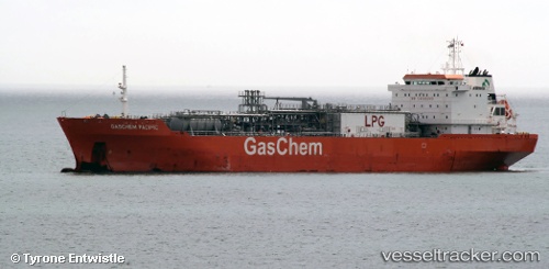
 NAVIGATOR VESTA
Current Status
Where is the vessel?
NAVIGATOR VESTA is currently in Near MOERDIJK, based on AIS data received less than 1h ago.
Latest AIS update:
Current position: 51.69179° N, 4.56034° E (Near MOERDIJK)
Average speed (last 7 days): Loading…
Average speed (last 30 days): Loading…
Vessel profile: NAVIGATOR VESTA is a Lpg Tanker with dimensions m x m.
This page combines live AIS, route history, probable destination signals, nearby traffic, and port activity for practical vessel monitoring.
The current position of vessel NAVIGATOR VESTA is 51.69179 lat / 4.56034 lng. Updated: 2026-04-16 21:56:36 UTCNearest reference points:
- Near STRIJENSAS
- Near MOERDIJK
- Near Mookhoek
Currently sailing under the flag of Liberia ![]()
Details:
Live Vessel NAVIGATOR VESTA Analytics (details, animations, etc.)
Recent AIS points (UTC):
2026-04-16 13:20:34 UTC · 51.69179, 4.56034 · SOG 0.1 kn · COG 73°2026-04-16 16:18:19 UTC · 51.69178, 4.56033 · SOG 0.1 kn · COG 74°
2026-04-16 20:15:40 UTC · 51.69178, 4.56034 · SOG 0.1 kn · COG 74°
2026-04-16 21:56:36 UTC · 51.69179, 4.56034 · SOG 0.1 kn · COG 74°