 vesseltracker.com
 JIN RONG
Current Status
Where is the vessel?
JIN RONG is currently in 246 nm E of MASIRAH, based on AIS data received about 1h ago.
Latest AIS update:
Current position: 20.33483° N, 63.22738° E (246 nm E of MASIRAH)
Average speed (last 7 days): Loading…
Average speed (last 30 days): Loading…
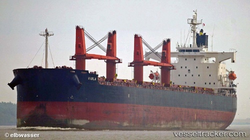
Vessel profile: JIN RONG is a Bulk Carrier with dimensions 190m x 32m.
This page combines live AIS, route history, probable destination signals, nearby traffic, and port activity for practical vessel monitoring.
The current position of vessel JIN RONG is 20.33483 lat / 63.22738 lng. Updated: 2026-04-09 02:11:51 UTCNearest reference points:
- 262 nm SE of SUR
- 224 nm E of SUR
- 231 nm SW of Keti Bandar
Currently sailing under the flag of Hong Kong, China ![]()
JIN RONG built in 2008 year
Deadweight:
58729 tDetails:
Live Vessel JIN RONG Analytics (details, animations, etc.)
Recent AIS points (UTC):
2026-04-08 15:05:47 UTC · 21.51910, 61.82540 · SOG 8.8 kn · COG -1°2026-04-08 15:59:39 UTC · 21.42982, 61.93367 · SOG 9.1 kn · COG 136°
2026-04-08 15:59:39 UTC · 21.42982, 61.93367 · SOG 9.1 kn · COG 136°
2026-04-09 02:11:51 UTC · 20.33483, 63.22738 · SOG 9.9 kn · COG 136°