 vesseltracker.com
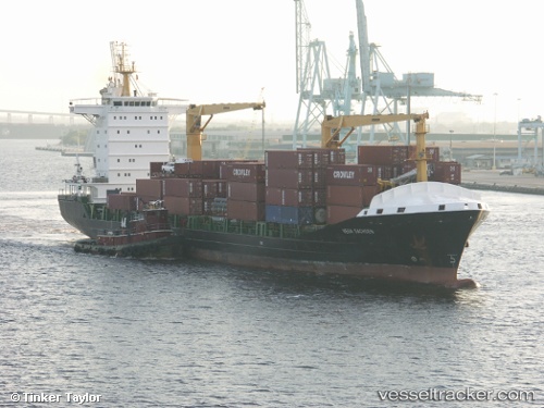
 CONTSHIP SKY
Current Status
Where is the vessel?
CONTSHIP SKY is currently in 10 nm W of Sant Antoni de Portmany, based on AIS data received less than 1h ago.
Latest AIS update:
Current position: 39.04427° N, 1.09109° E (10 nm W of Sant Antoni de Portmany)
Average speed (last 7 days): Loading…
Average speed (last 30 days): Loading…
Vessel profile: CONTSHIP SKY is a Container Ship with dimensions m x m.
This page combines live AIS, route history, probable destination signals, nearby traffic, and port activity for practical vessel monitoring.
The current position of vessel CONTSHIP SKY is 39.04427 lat / 1.09109 lng. Updated: 2026-04-02 00:10:24 UTCNearest reference points:
- Near SANT ANTONI
- 18 nm NW of Sant Antoni de Portmany
- Near Sant Antoni de Portmany
Currently sailing under the flag of Liberia ![]()
Details:
Live Vessel CONTSHIP SKY Analytics (details, animations, etc.)
Recent AIS points (UTC):
2026-04-01 17:29:22 UTC · 37.76500, 0.60167 · SOG 12 kn · COG -1°2026-04-01 19:33:35 UTC · 38.17637, 0.76234 · SOG 12.8 kn · COG 7°
2026-04-01 22:05:44 UTC · 38.67226, 0.93203 · SOG 11.8 kn · COG 14°
2026-04-02 00:10:24 UTC · 39.04427, 1.09109 · SOG 10.6 kn · COG 20°