 vesseltracker.com
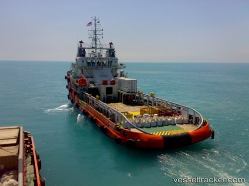
 HIRAB
HIRAB
Current Status
Where is the vessel?
HIRAB is currently in Near Nha Be, based on AIS data received about 1h ago.
Latest AIS update:
Current position: 10.70042° N, 106.75371° E (Near Nha Be)
Average speed (last 7 days): Loading…
Average speed (last 30 days): Loading…
Vessel profile: HIRAB is a Offshore Tug/Supply Ship with dimensions 15m x 59m.
This page combines live AIS, route history, probable destination signals, nearby traffic, and port activity for practical vessel monitoring.
The current position of vessel HIRAB is 10.70042 lat / 106.75371 lng. Updated: 2026-04-04 07:12:42 UTCNearest reference points:
- Near Nha Be
- Near Cat Lai Oil Port
- Near Saigon Petro Oil Terminal
Currently sailing under the flag of Tanzania ![]()
HIRAB built in 2007 year
Deadweight:
1364 tDetails:
Live Vessel HIRAB Analytics (details, animations, etc.)
Recent AIS points (UTC):
2026-04-04 01:15:41 UTC · 10.69863, 106.75455 · SOG 0 kn · COG 345°2026-04-04 03:39:40 UTC · 10.69862, 106.75456 · SOG 0 kn · COG 345°
2026-04-04 05:33:42 UTC · 10.69983, 106.75371 · SOG 0 kn · COG 137°
2026-04-04 07:12:42 UTC · 10.70042, 106.75371 · SOG 0 kn · COG 162°