 vesseltracker.com
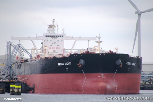
 FRONT SIGNE
Current Status
Where is the vessel?
FRONT SIGNE is currently in 290 nm SW of Veraval, based on AIS data received about 2h ago.
Latest AIS update:
Current position: 16.74167° N, 67.74333° E (290 nm SW of Veraval)
Average speed (last 7 days): Loading…
Average speed (last 30 days): Loading…
Vessel profile: FRONT SIGNE is a Crude Oil Tanker with dimensions 330m x 330m.
This page combines live AIS, route history, probable destination signals, nearby traffic, and port activity for practical vessel monitoring.
The current position of vessel FRONT SIGNE is 16.74167 lat / 67.74333 lng. Updated: 2026-04-09 15:22:37 UTCNearest reference points:
- 306 nm SW of Veraval
- 236 nm SW of Veraval
- 282 nm W of RATNAGIRI
Currently sailing under the flag of Marshall Islands ![]()
FRONT SIGNE built in 2010 year
Deadweight:
297007 tDetails:
Live Vessel FRONT SIGNE Analytics (details, animations, etc.)
Recent AIS points (UTC):
2026-04-09 09:43:34 UTC · 16.13333, 68.38333 · SOG 10 kn · COG -1°2026-04-09 10:40:35 UTC · 16.25667, 68.25333 · SOG 11 kn · COG -1°
2026-04-09 13:12:40 UTC · 16.46555, 68.06157 · SOG 11.1 kn · COG -1°
2026-04-09 15:22:37 UTC · 16.74167, 67.74333 · SOG 11 kn · COG -1°