 vesseltracker.com
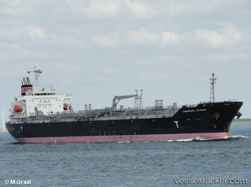
 CHEMROAD JOURNEY
Current Status
Where is the vessel?
CHEMROAD JOURNEY is currently in 34 nm NW of MORRO DEL JABLE, based on AIS data received less than 1h ago.
Latest AIS update:
Current position: 28.48383° N, 14.78018° W (34 nm NW of MORRO DEL JABLE)
Average speed (last 7 days): Loading…
Average speed (last 30 days): Loading…
Vessel profile: CHEMROAD JOURNEY is a Chemical/Oil Products Tanker with dimensions 175m x 175m.
This page combines live AIS, route history, probable destination signals, nearby traffic, and port activity for practical vessel monitoring.
The current position of vessel CHEMROAD JOURNEY is 28.48383 lat / -14.78018 lng. Updated: 2026-04-15 03:43:29 UTCNearest reference points:
- Near Las Palmas
- Near Las Palmas de Gran Canaria
- Near TALIARTE
Currently sailing under the flag of Panama ![]()
CHEMROAD JOURNEY built in 2009 year
Deadweight:
33526 tDetails:
Live Vessel CHEMROAD JOURNEY Analytics (details, animations, etc.)
Recent AIS points (UTC):
2026-04-14 19:34:54 UTC · 26.83764, -15.45250 · SOG 12.3 kn · COG -1°2026-04-14 21:45:26 UTC · 27.25837, -15.28010 · SOG 12.7 kn · COG 21°
2026-04-14 23:40:56 UTC · 27.64049, -15.11554 · SOG 13.2 kn · COG 23°
2026-04-15 03:43:29 UTC · 28.48383, -14.78018 · SOG 13.2 kn · COG 16°