 vesseltracker.com
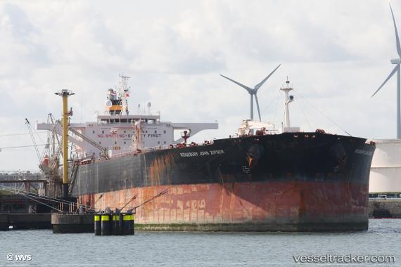
 OCEAN THUNDER
Current Status
Where is the vessel?
OCEAN THUNDER is currently in Near Choa Chu Kang, based on AIS data received less than 1h ago.
Latest AIS update:
Current position: 1.26947° N, 103.91258° E (Near Choa Chu Kang)
Average speed (last 7 days): Loading…
Average speed (last 30 days): Loading…
Vessel profile: OCEAN THUNDER is a Crude Oil Tanker with dimensions m x m.
This page combines live AIS, route history, probable destination signals, nearby traffic, and port activity for practical vessel monitoring.
The current position of vessel OCEAN THUNDER is 1.26947 lat / 103.91258 lng. Updated: 2026-04-19 14:04:17 UTCNearest reference points:
- Near Tampines
- Near Choa Chu Kang
- Near Changi
Currently sailing under the flag of Panama ![]()
Details:
Live Vessel OCEAN THUNDER Analytics (details, animations, etc.)
Recent AIS points (UTC):
2026-04-19 10:18:06 UTC · 1.26833, 103.91167 · SOG 0 kn · COG -1°2026-04-19 12:07:11 UTC · 1.26945, 103.91251 · SOG 0 kn · COG 70°
2026-04-19 13:43:14 UTC · 1.26946, 103.91255 · SOG 0 kn · COG 54°
2026-04-19 14:04:17 UTC · 1.26947, 103.91258 · SOG 0 kn · COG 54°