 vesseltracker.com
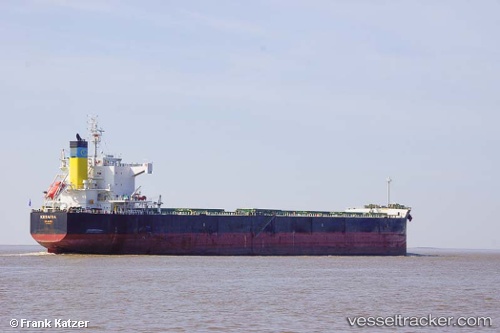
 KESARIA
Current Status
Where is the vessel?
KESARIA is currently in Near Vancouver Harbour Water Apt/Vancouver, based on AIS data received less than 1h ago.
Latest AIS update:
Current position: 49.28833° N, 123.06667° W (Near Vancouver Harbour Water Apt/Vancouver)
Average speed (last 7 days): Loading…
Average speed (last 30 days): Loading…
Vessel profile: KESARIA is a Bulk Carrier with dimensions m x m.
This page combines live AIS, route history, probable destination signals, nearby traffic, and port activity for practical vessel monitoring.
The current position of vessel KESARIA is 49.28833 lat / -123.06667 lng. Updated: 2026-03-29 13:28:55 UTCNearest reference points:
- Near North Vancouver
- Near Vancouver
- Near English Bay
Currently sailing under the flag of Malta ![]()
Details:
Live Vessel KESARIA Analytics (details, animations, etc.)
Recent AIS points (UTC):
2026-03-29 07:52:52 UTC · 49.28833, -123.06667 · SOG 0 kn · COG -1°2026-03-29 09:54:15 UTC · 49.28921, -123.06810 · SOG 0 kn · COG 181°
2026-03-29 11:57:01 UTC · 49.28923, -123.06809 · SOG 0 kn · COG 181°
2026-03-29 13:28:55 UTC · 49.28833, -123.06667 · SOG 0 kn · COG -1°